The Capitol Hill Graphic Standards Manual
Selected by the Architect of the Capitol in 1977 to develop a way-finding system to direct visitors in the Capitol Hill area to a specific government building and/or a specific office within that building.
The area includes the Capitol building, 3 Senate Office Buildings (Hart, Dirksen, Russell), 3 House Office Buildings (Cannon, Rayburn, Longworth), the Supreme Court, 3 Library of Congress buildings (Jefferson, Folger, Madison) plus the Botanic Garden.
The initial concept was to develop a minimal exterior sign system (Building Identification and a Directory Map of Capitol Hill). The second phase was to develop a system of interior sign components which could be serviced by the Capitols own maintenance staff rather than relying on outside contractors. The final phase was the production of a Graphics Standards Manual to insure consistency throughout the program.
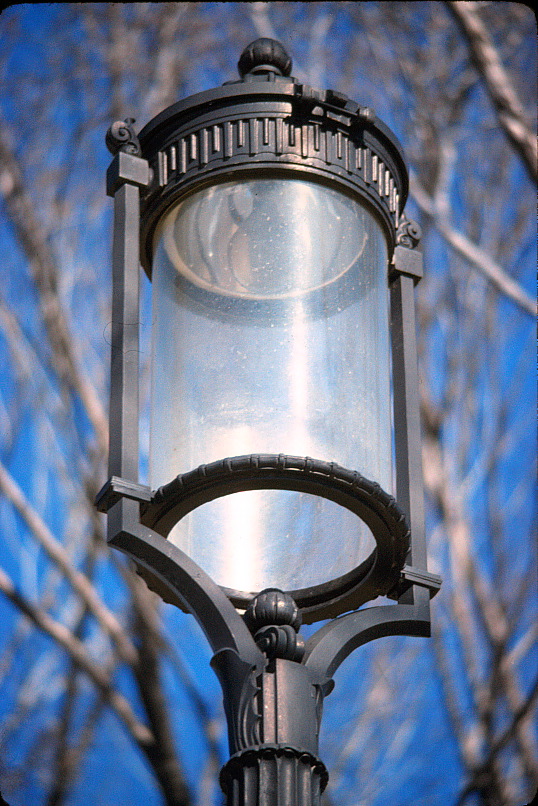
The design of all new exterior components of the way-finding system, (Directory Map and Building Identification) were influenced by details from existing Capitol Hill fixtures that were originally designed by Frederic Law Olmsted.
Existing signage in most building’s were done with varying materials, lacked consistency or were in a state of disrepair.
THE DIRECTORY MAP
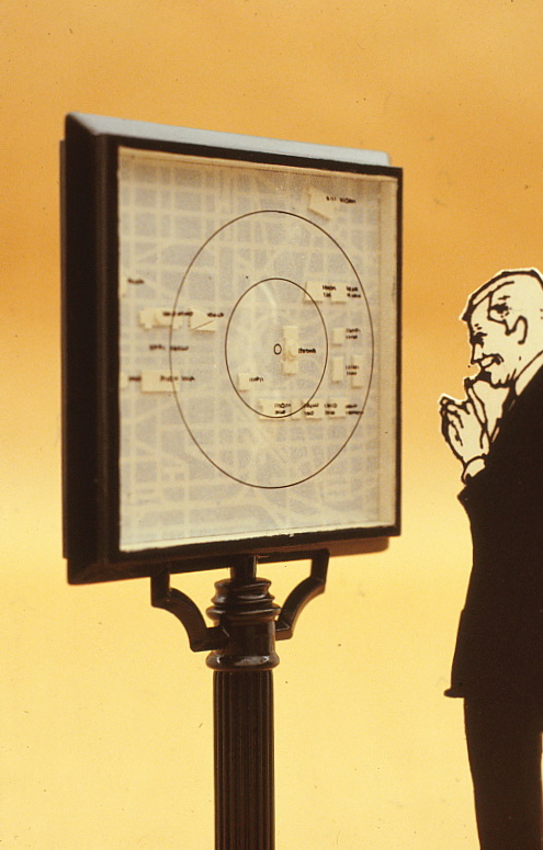
All buildings on the Hill are identified and a “You are here“ overlay provided walking time and distance to each building.
A 3’ x 3’ dimensional map was proposed showing the Capitol Hill area and all the buildings under the jurisdiction of the Architect of the Capitol. Contained in a metal frame and cast iron support elements, the details reflected the Olmsted designed street lights.
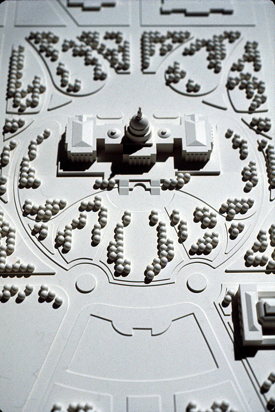
A 3-dimensional map was proposed to tie in with the maps developed for the National Mall program.
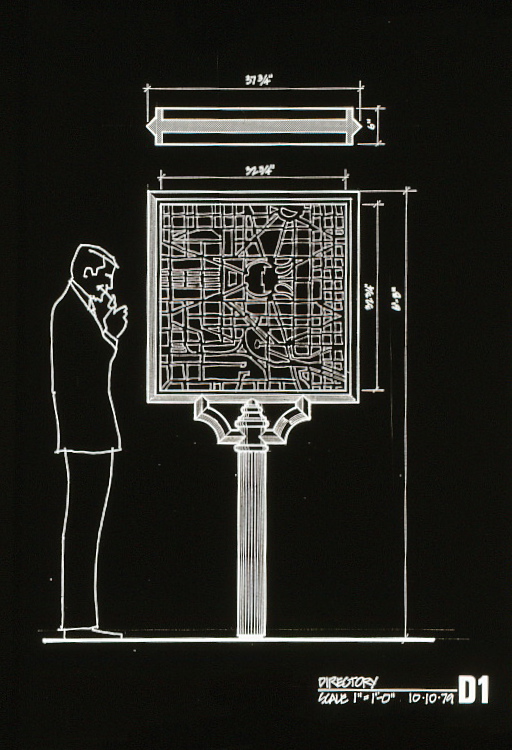
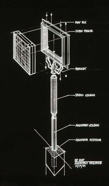
Design schematics for the Capitol Hill Directory
THE BUILDING IDENTIFICATION
Free-standing identification signs of each building are located street side directly perpendicular to it's entrance. They also use a cast metal frame and cast iron support elements reflecting the Olmsted designed street fixtures on Capitol Hill. The double-sided street sign consists of 2’ x 3’ porcelain enamel sign panels.
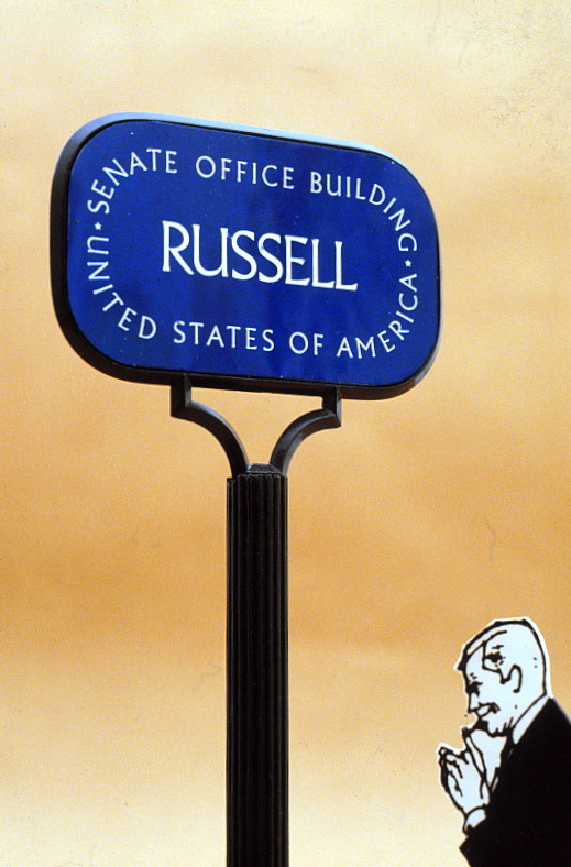
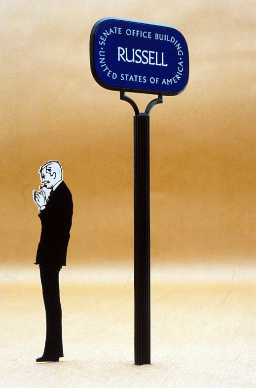
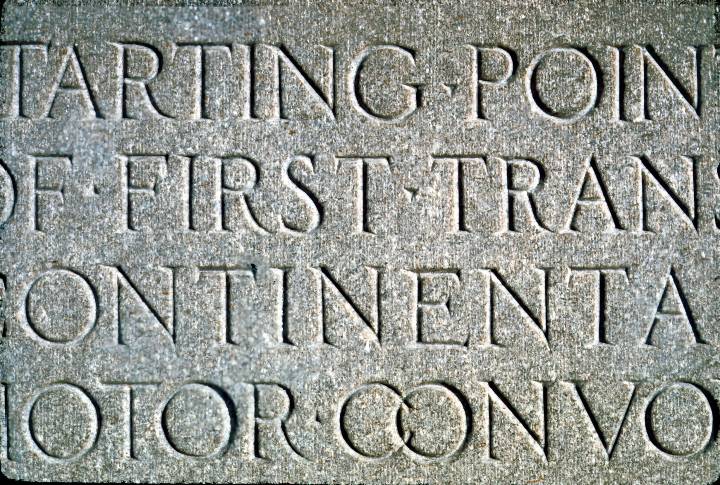
The selection of a font for the project was influenced by the chiseled text on the “Zero Milestone” for the Lincoln Highway located on the Mall, marking the beginning of the Lincoln Highway.
THE SECURITY DESK
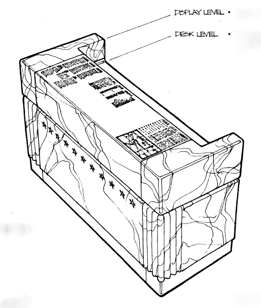

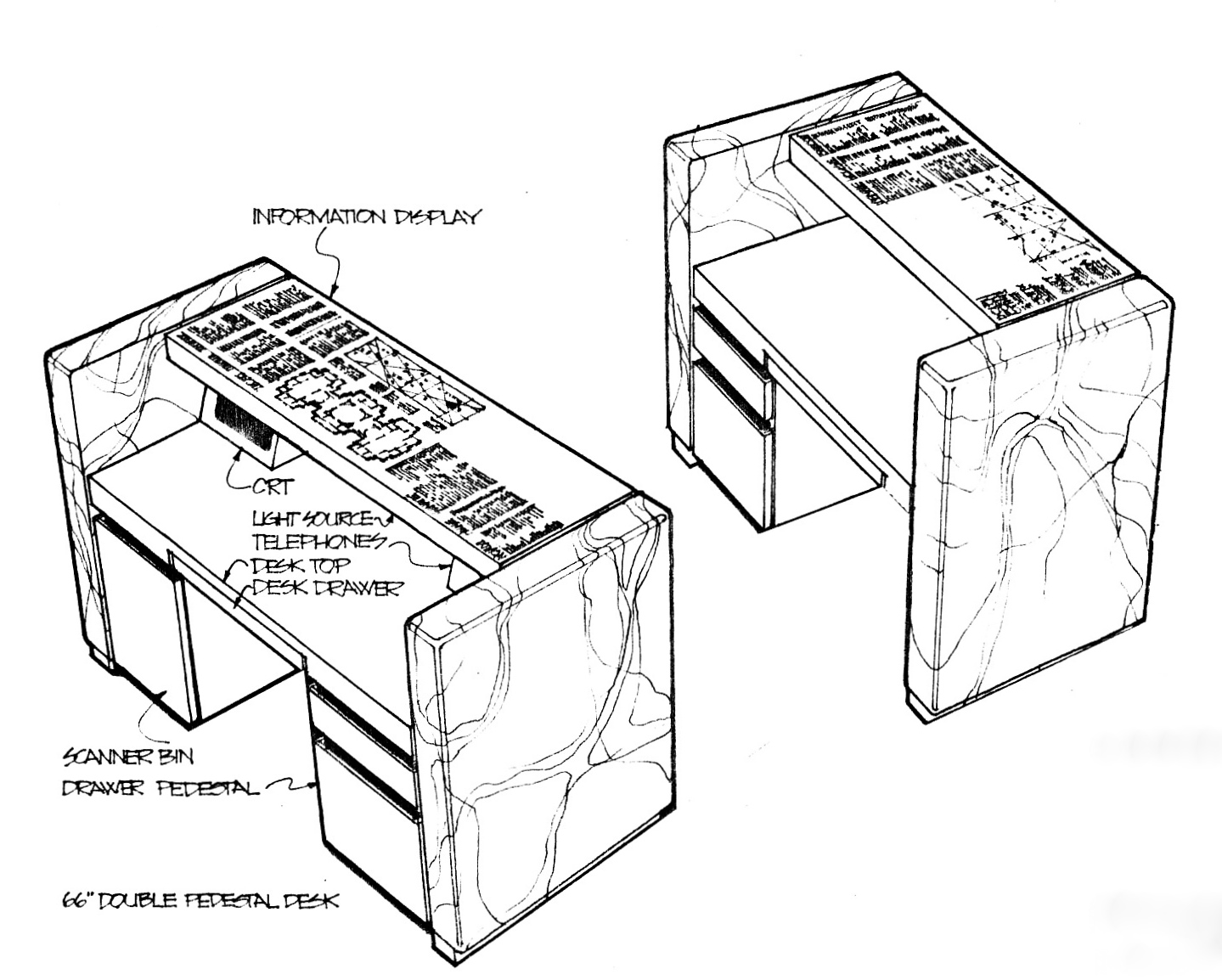
Visitors must pass a security desk on entering all buildings. A proposed addition to the desks was to facilitate visitor information with plans & maps.
A Map Pad was proposed to assist security in sending the individual with information relative to finding a specific building or office.
A Map Pad was proposed to assist security in sending the individual with information relative to finding a specific building or office.
Capitol building's desk with overall plan
All desks would be modified to include plans
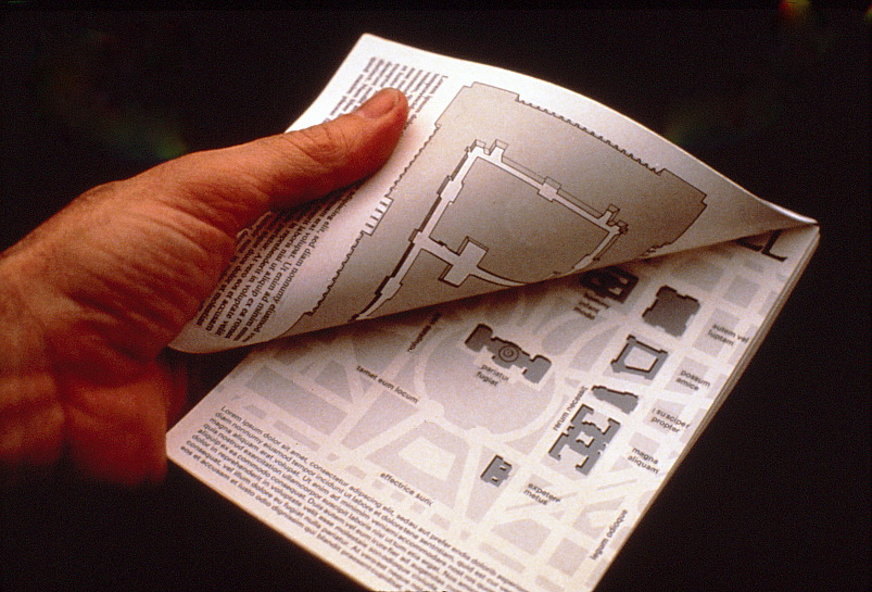
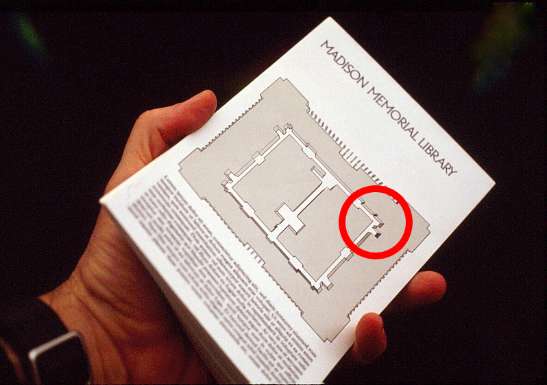
THE HANDOUT DIRECTORY MAP
A standard Map Pad for each building was proposed as an assist to Security Desk personnel offers specific building directions by marking the building, the floor plan and a general location of the office. This sheet is then given to the visitor to serve as a guide to their destination.
Front sheet shows all Capitol Hill buildings
Reverse side shows a specific building plan
Each plan is noted to show a specific location
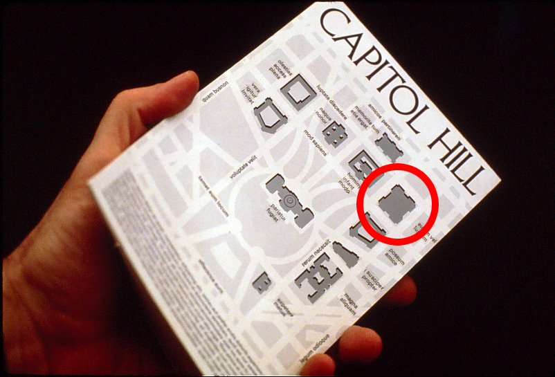
Security highlights a specific building on the Hill
Security flips to a plan of that building
Security highlights an area inside the building
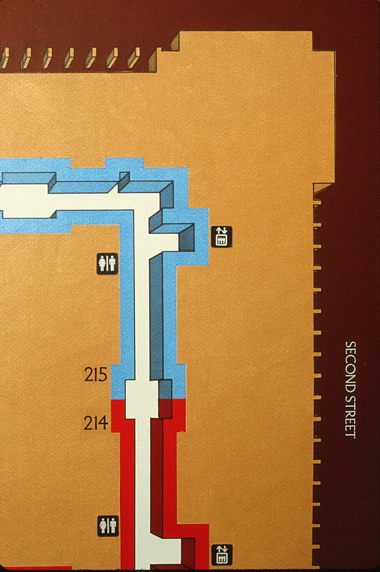
THE BUILDING DIRECTORY SIGNS
Rendered in one point perspective, individual floor plans for each building concentrated on showing only public corridors and services available in the building.
Quadrants are color-coded and each plan is oriented true north putting the viewer in correct relation to the building's location.
Room numbers call-out each public entry.
Quadrants are color-coded and each plan is oriented true north putting the viewer in correct relation to the building's location.
Room numbers call-out each public entry.
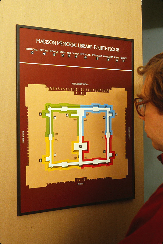
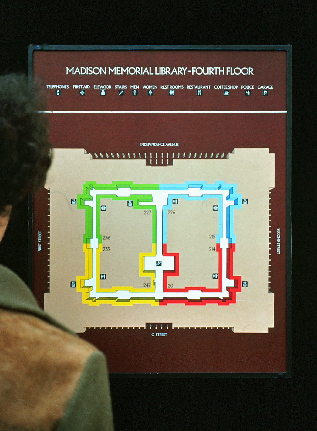
A typical wall mounted directory. Colors identify specific areas of the building.
Plans are oriented to a visitor's actual position in the building.
All public entries and public facilities are identified at each level of the building.
TYPOGRAPHY
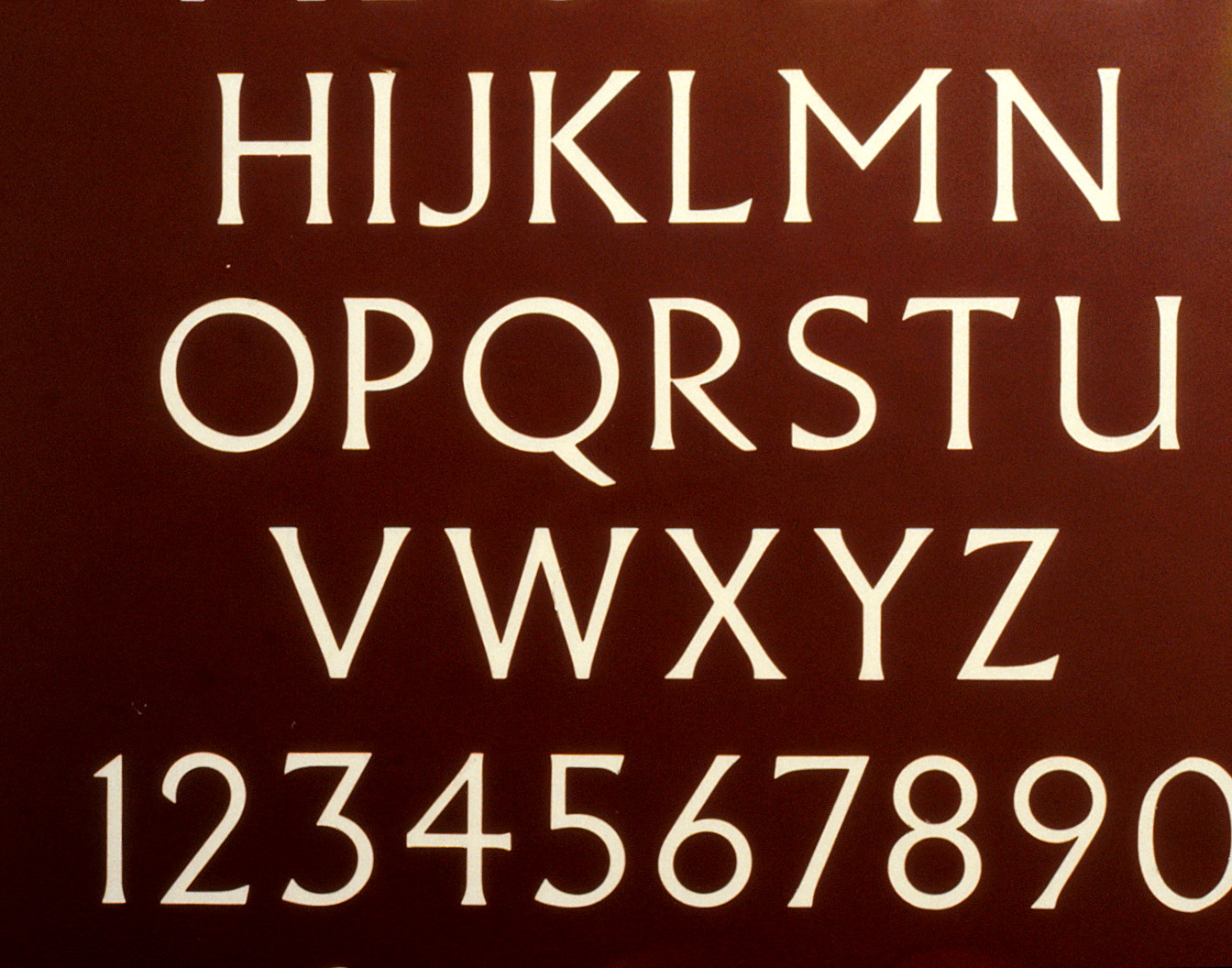
A number of classic fonts are found in use on Capitol Hill. The selection of a standard serif type font, Albertus Light, seemed appropriate for this project. This selection was again influenced by the chiseled font used on the “Zero Milestone” located on the Mall marking the beginning of the Lincoln Highway.
In order to meet the pending ADA requirements requiring braille, a method of adapting an existing print technology was used to add dimension to the sign. All signs have raised letters and braille as a result. Consequently, this method evolved to become an industry standard.

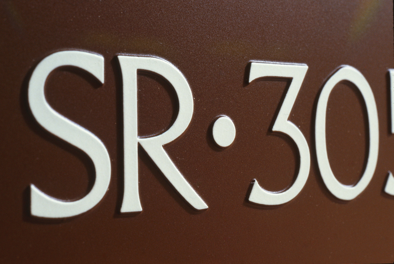
Simplified Directories use an alpha-numeric system, combining initials for its function and the building name.
S for Senate and H for House.
S for Senate and H for House.
The Russell Senate Office Building
is identified as SR,
the Dirksen as SD,
the HART as SH.
is identified as SR,
the Dirksen as SD,
the HART as SH.
The Cannon House Building
is identified as HC,
the Longworth as HL,
the Rayburn as HR.
is identified as HC,
the Longworth as HL,
the Rayburn as HR.
Other buildings followed suit: the Supreme Court as SC, Library of Congress (Madison) as LM, and the Capitol as C.
ROOM IDENTIFICATION SYSTEM
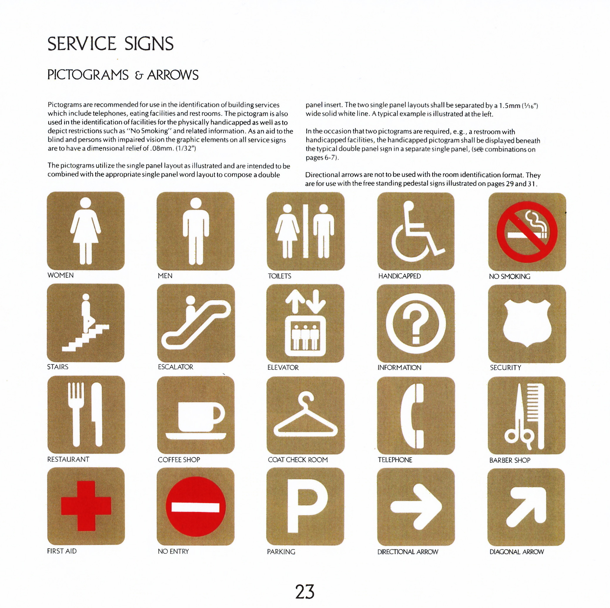
A modular approach was taken to arrange combinations of room numbers, individual names, specific departments and pictograms identifying functions.
Room numbers call-out each public entry.
Room numbers call-out each public entry.
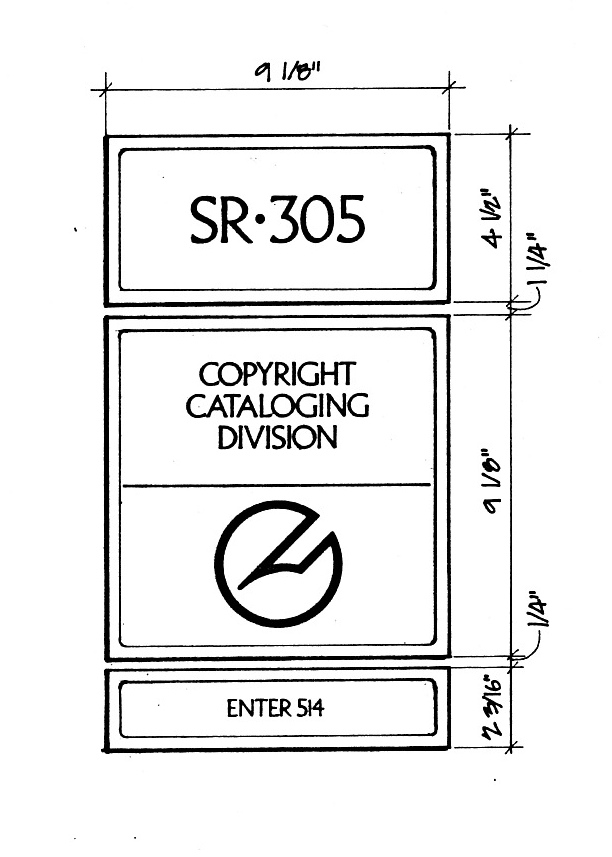
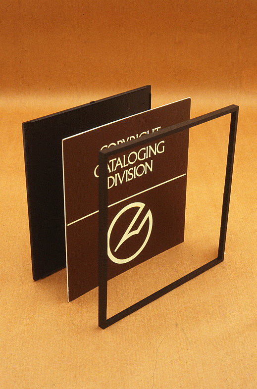
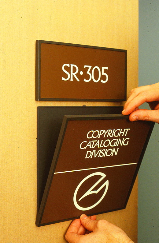
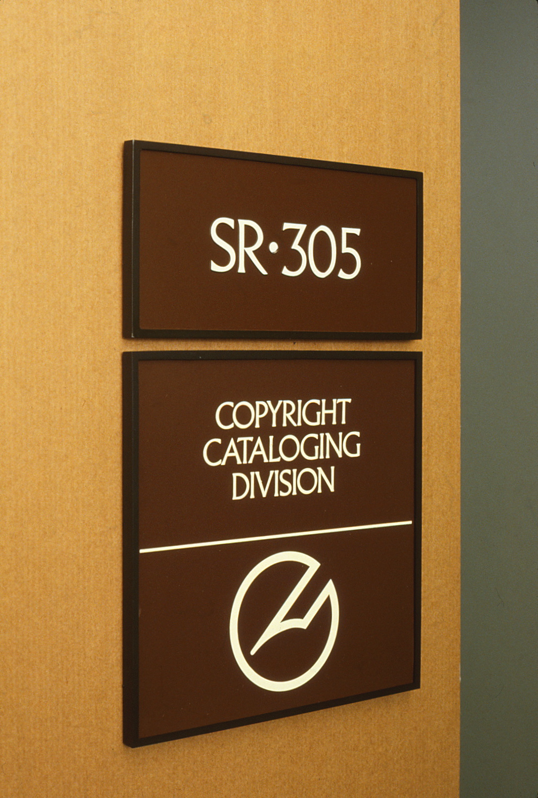
A single + double + half panel layout
Base + insert + frame assembly
Wall mount installation
Typical wall installation
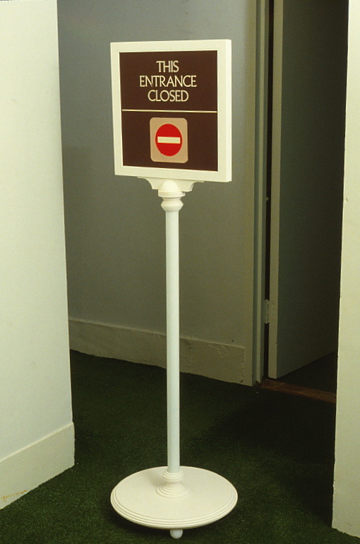
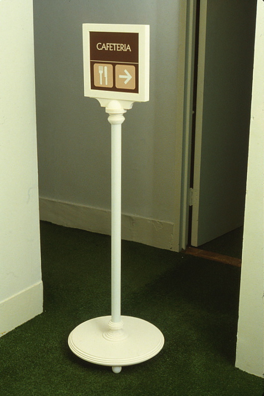
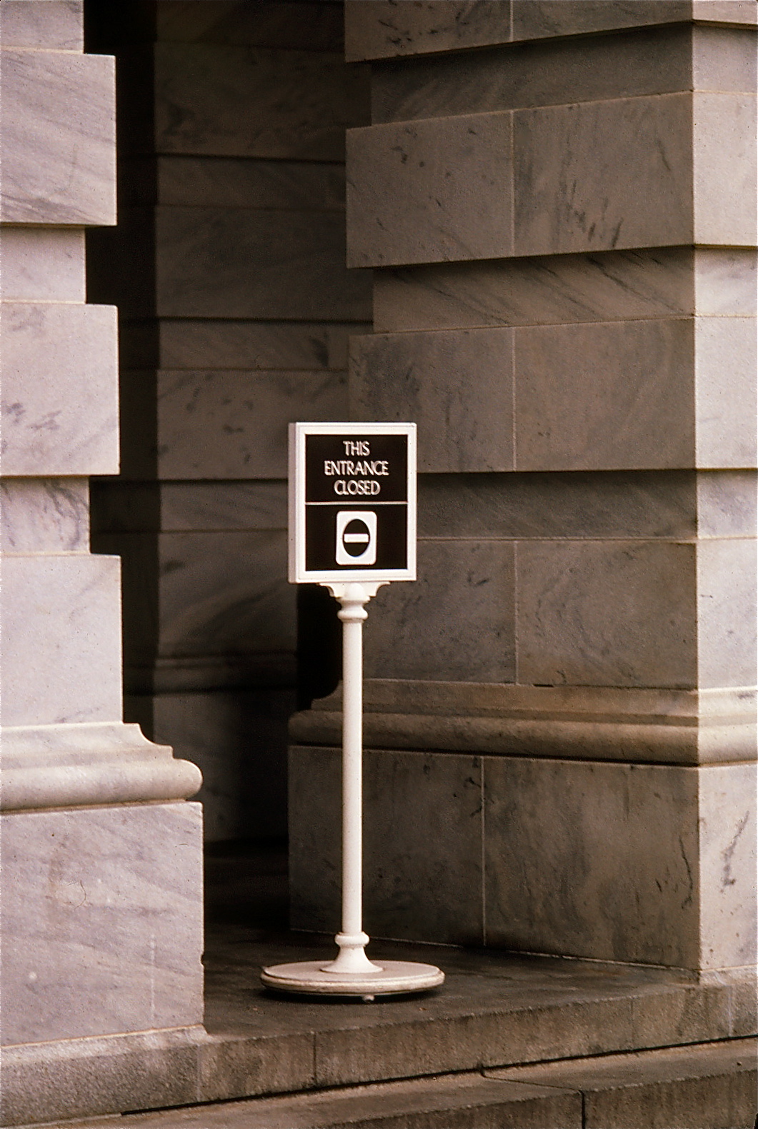
THE PORTABLE SIGNS
Due to the nature of the constantly changing patterns of traffic in the halls of the Capitol and other Congressional buildings, a series of free-standing signs have been used over the years.
These were updated and developed for placement within corridors or used in exterior applications.
These were updated and developed for placement within corridors or used in exterior applications.
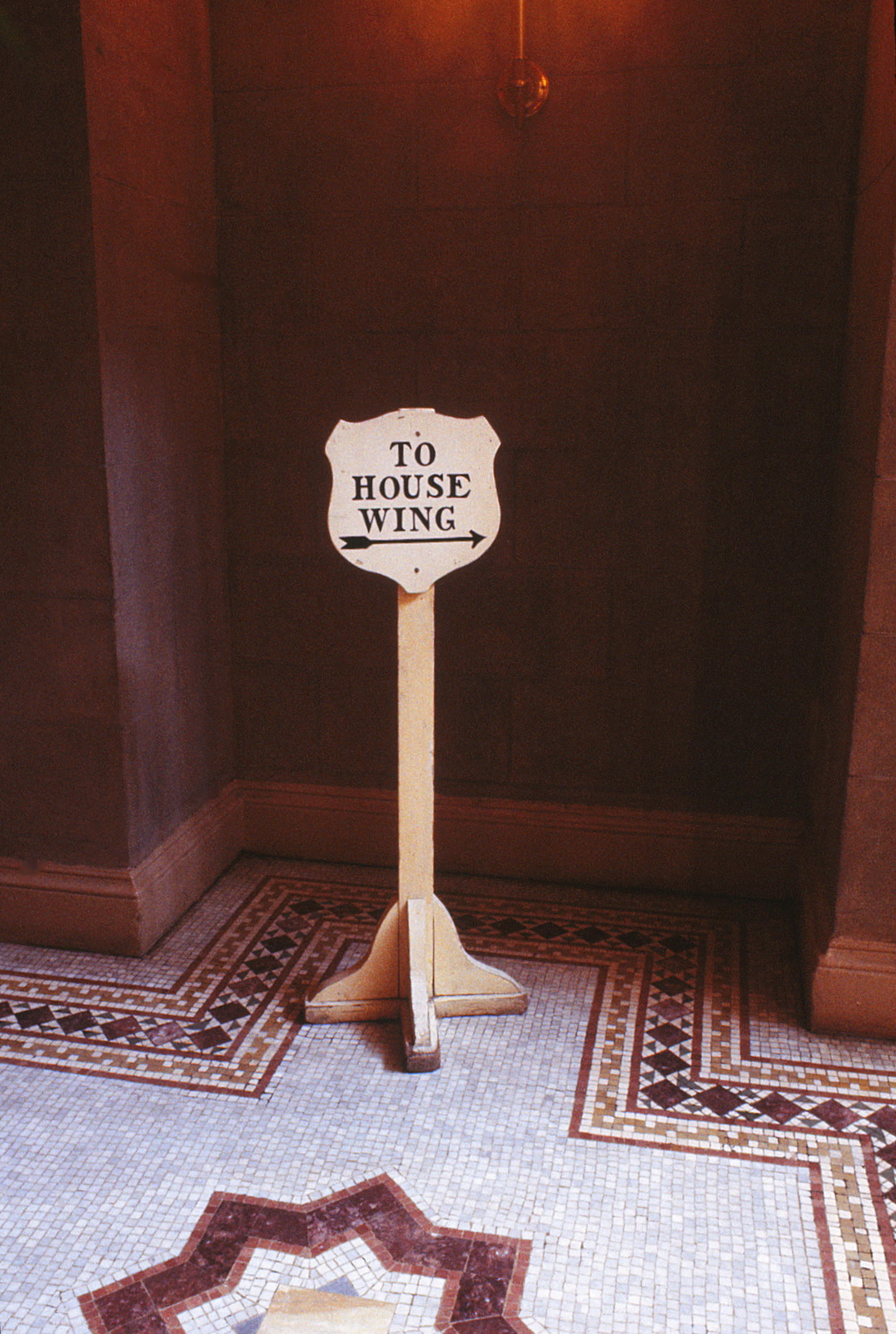
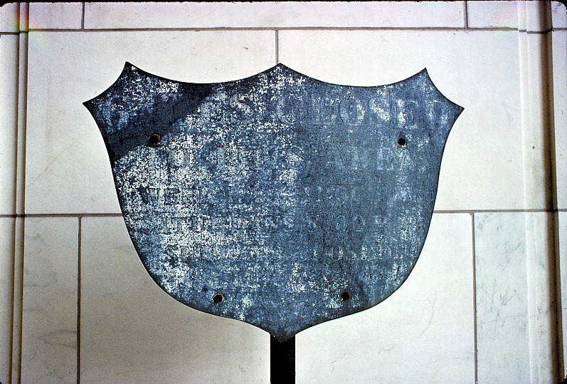
Former directional sign
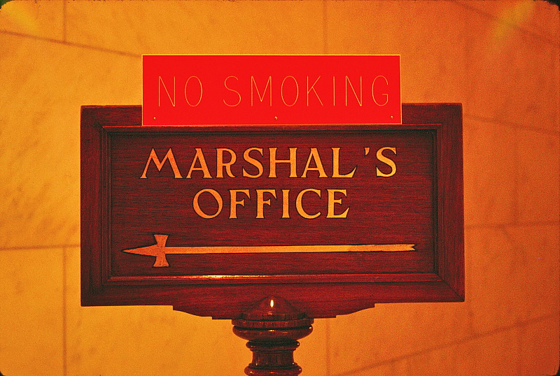
Regulatory message
Directional message
Exterior implementation
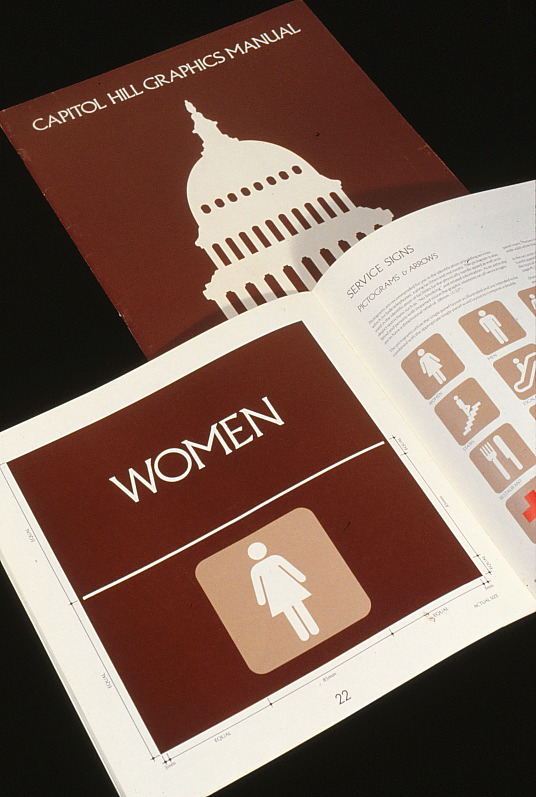
THE GRAPHIC STANDARDS MANUAL
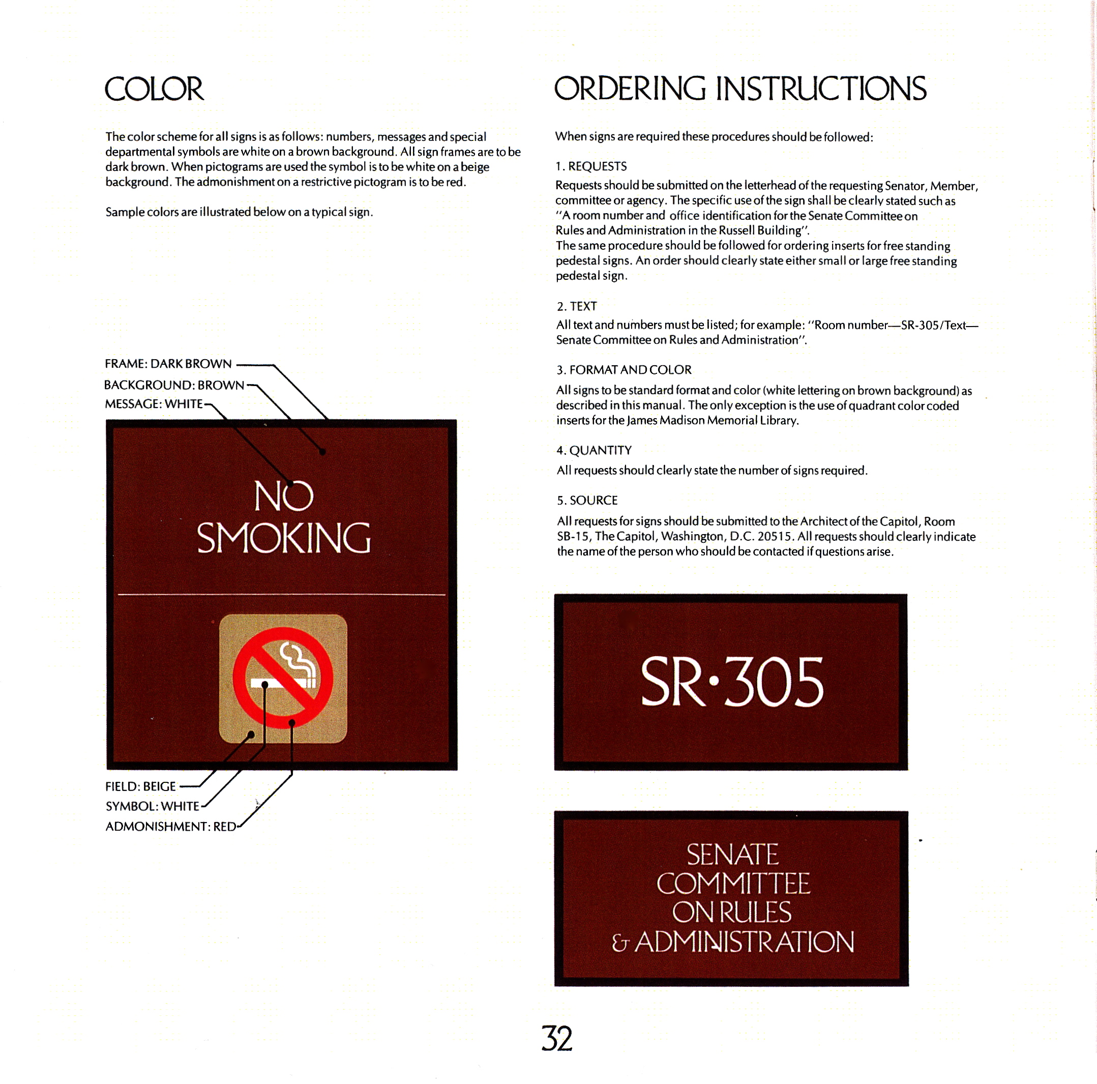
A Graphic Standards Manual was prepared to assist implementation of the system. Serving as a catalog, the user need only supply information regarding the sign type and the message required.
All sign panels and removable frames are a commercially available standard sign product. A proofing system (Chromalin), developed for the printing industry, was adapted for the in-house production of all non-dimensional inserts.
All sign panels and removable frames are a commercially available standard sign product. A proofing system (Chromalin), developed for the printing industry, was adapted for the in-house production of all non-dimensional inserts.
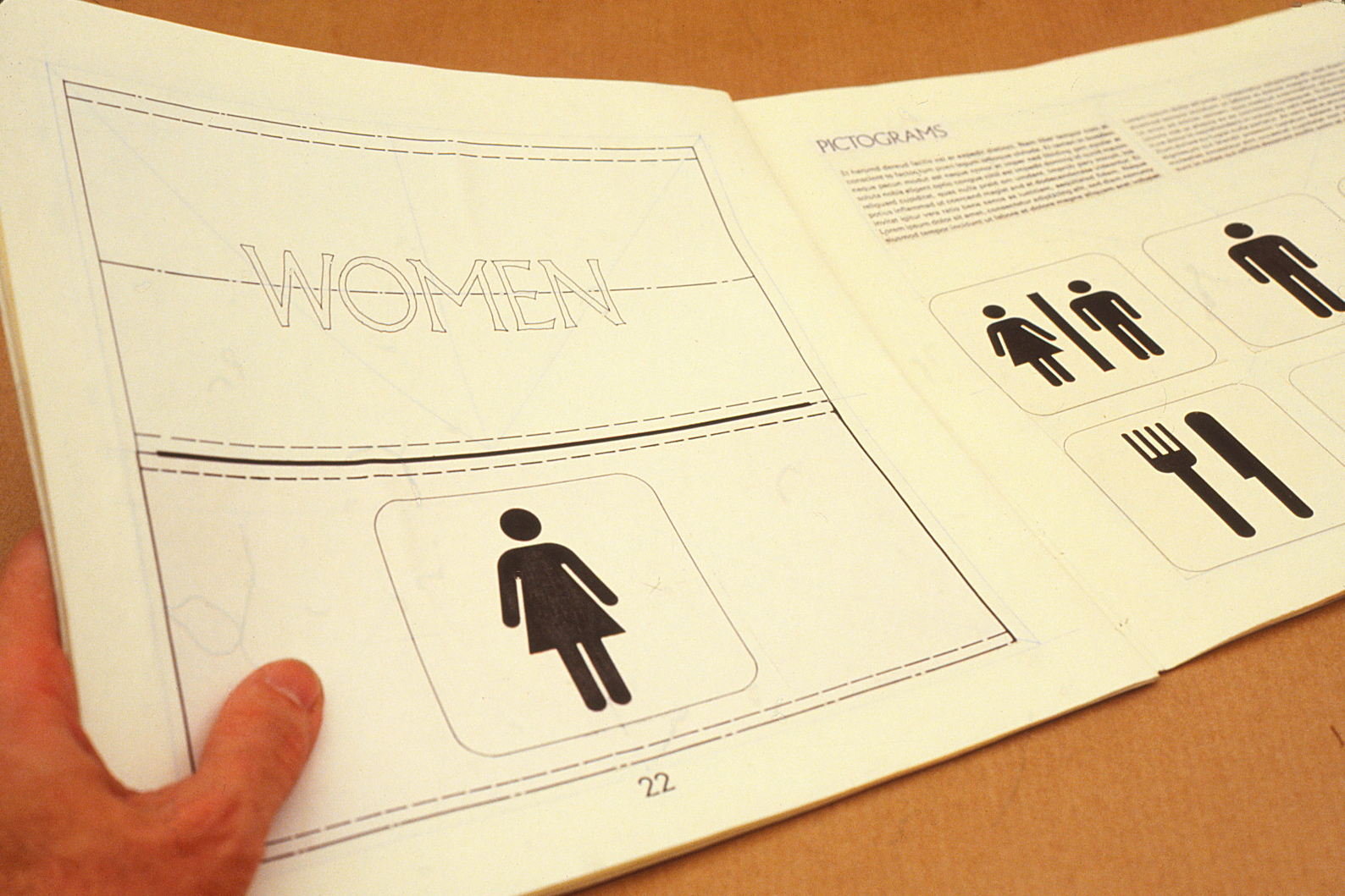
The Graphic Standard Manual's 24 pages covered all interior signage requirements for all 12 buildings of the Capitol Hill complex.